A snow alert has been issued across huge swathes of Britain, with forecasters warning of a polar blast.
The Met Office says colder air is feeding from the north across many parts of the UK over the next few days, bringing the potential for wintry showers. This could mean snow and ice - initially in the north and across North Sea coastal areas, but possibly in the south by the weekend.
It comes as the UK Health Securty Agency (UKHSA) has issued a yellow cold-health alert for the health sector covering northern regions of England, which runs through the whole week. The Met Office has also revealed where and when snow and ice will hit across the UK after new yellow weather warnings were issued this morning. After a wet start to the week, forecasters say that the weather will now turn a lot colder and for the "foreseeable future" with the icy conditions expected to continue well into December.
A low pressure that brought the rain on Monday has moved away but it will be cold today with bands of rain and snow moving down through Scotland. Weather maps from WXCharts show the temperatures for the rest of the week getting as low as -6C in northern parts of the UK on Friday while the mercury is sub zero in most areas.
David Oliver, a Met Office deputy chief meteorologist, explains: “After some rain on Monday, conditions will turn mainly dry in the south for a time before a very uncertain period on Thursday and Friday for the southern half of England and Wales. The weather models are highlighting several possible solutions from very wet to mainly dry, with a mainly dry picture the most probable outcome at present.
“However, some models include the prospect of an area of low pressure developing and moving in from the south or southwest. If this solution proves to be correct, we could see an area of warmer and moisture-laden air ‘bumping’ into the cold air further north. Along the boundary of the two air masses lies a zone across southern and central Britain where snowfall could develop fairly widely. He added: "Snow in any affected area is unlikely to be anything more than transient and short-lived, but it could lead to small totals and some disruption over a few hours before melting."
Snowfall in late autumn or early winter doesn’t generally linger – especially in southern Britain - because ground temperatures broadly remain relatively high after the summer, especially compared with values in late winter, after the ground loses more of its warmth, the Met Office says.
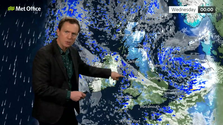
BBC forecaster Darren Bett said that it "looks like we are going to stay in the cold air for the foreseeable future". Looking to this week, he said: "For many I think it is going to be a dry day on Tuesday with more in the way of sunshine actually but the air is getting a bit colder, temperatures 5C to 7C.
"Light winds and clear skies though overnight Tuesday night means more widespread frost actually, temperatures could be as low as -4C or -5C in some parts of Scotland." On Wednesday it is likely to remain bitterly cold throughout the day and in Glasgow it may not get above 2C throughout the day."
The Met Office map shows the areas under a yellow cold weather alert:
- Liverpool
- Blackpool
- Chester
- Manchester
- Leeds
- York
- Hull
- Scarborough
- Carlisle
- Newcastle
- Middlesbrough